

The ontology of a UK Postcode
The UK Postcode system was initially developed by the Royal Mail in 1857 and has been used in its present form since the late seventies.
Today, the Postcode is a group of between 5 and 7 letters and numbers that identify a group of houses or addresses. Each Postcode denotes a hierarchical system of location which is brilliantly assembled as a layman’s latitude and longitude interwoven within complex geographic regions which are comprised within the counties, boroughs, parishs, wards, and local authority districts.
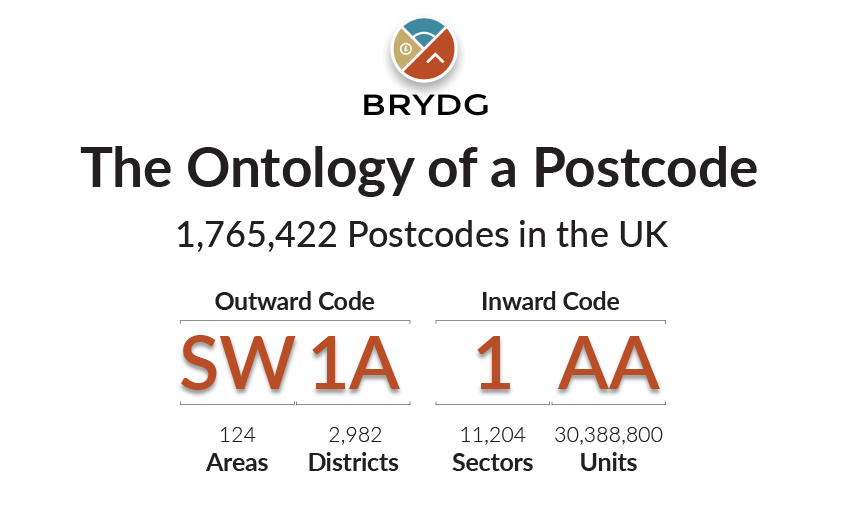
The ontology of the Postcode is broken up into 4 levels and each level represents a more precise spatial boundary. The first and largest level is the Area, followed by the District, then Sector, and finally Unit. The first two levels of Area and Sector collectively form the Outward Code (aka Outcode) followed by a space and then the Inward Code (aka Incode) which is comprised of the Sector and specific Unit.
There are approximately 1.8 million unit postcodes in use to reach the 30.6 million addresses in the UK. Each Postcode covers an average of about 15 properties, however in reality it can be anywhere between 1 and 100. Further, Postcodes are not static as new properties are constantly being built whilst old ones are being demolished.
As of the writing of this article, there are exactly 1,765,422 total Postcodes broken down into 124 Areas, 2,982 Districts and 11,204 Sectors.
Additional Brydg:
Website: http://brydg.com
Twitter: https://twitter.com/Brydgcom
Facebook: https://www.facebook.com/pg/brydg/about/
LinkedIn: https://www.linkedin.com/company/brydg/
Instagram: https://www.instagram.com/brydg_/
